
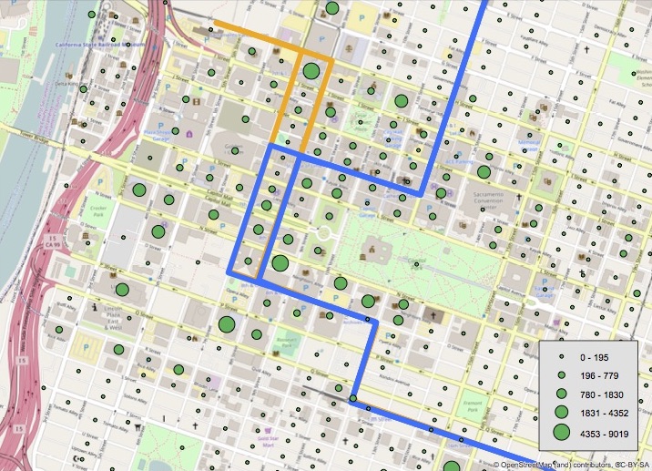
The question was asked: “Where are the jobs downtown, and how does that relate to light rail and streetcar alignments?” So we grabbed employment data by block from the Longitudinal Employment-Household Dynamics census website. “Blocks” in the census sense sometimes are actual city blocks, but may also be portions of blocks (such as, north of the alley), or may contain several physical blocks.
Some caveats about this employment data and implications for transit:
- work-related trips are only about 15% of all trips; however, their importance is greater than this because these trips mostly occur during times of “congestion” which affects people’s perceptions of traffic and the actions of transportation agencies
- trips by all modes include shopping, socialization, medical, recreation, and many others, so employment is just one aspect of trip generation
- this data does not show where the people are coming from, where they live; this data is available but we have only just begun to look at it; it does affect transit because some sources are on or close to the transit network while others are not
- the data is from 2014, so does not reflect changes that may have taken place as a result of the Golden 1 Center itself and other redevelopment; a number of large projects are underway that will also change employment patterns
The map below shows employment centers relative to the existing light rail alignments in downtown. It does not show the possible re-alignment of light rail to H St between 12th and 7th, nor the route of the streetcar but you can visualize these from this map (also available as pdf). Please note that STAR has not taken a position on either the light rail re-alignment to H St nor on the streetcar project, but we continue to monitor both of these as these will have a huge impact on transit in the central city.
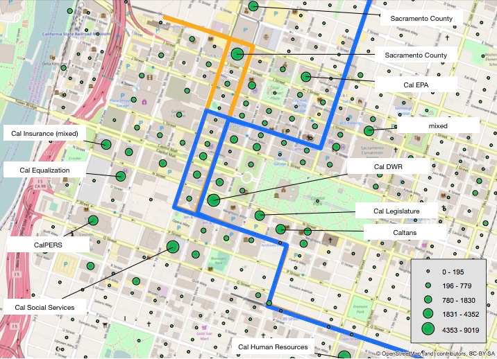
The next question for many people, is “what are these larger employment points,” so here is a map with the larger points labeled. Most of these are government buildings, no surprise there, but there are also some mixed use buildings that contain both government agencies and private businesses.
These maps are an update to the Getting Around Sacramento post, SacRT and Employment, with a focus on downtown and employment data at the block (smaller) rather than tract (larger) level.
Next up: back to the series on light rail in downtown, with a post on 12th St light rail

One thought on “Employment patterns downtown”