
Jim Brown of Sacramento Area Bicycle Advocates (SABA) presented last night at the joint Sacramento Bicycle Advisory Committee (SacBAC) on some weaknesses of the Grid 3.0 Plan Preferred Bicyclist Network (see map at bottom), and potential solutions to these weaknesses. Jim pointed out that there is a bicyclist network hole around the Golden 1 Center, with almost no way to or from the center, nor the many other destinations nearby, and that also left gaps in the network for people making through trips unrelated to these destinations. I (Dan) had a brief but useful conversation with Jim afterwards about general principles and about some specific streets. The earlier post on Transit Streets on 7th and 8th said “It is not clear whether bikes should be encouraged on this transit street.” The NACTO diagram showed a transit street with bus lane with no bicyclist facilities, and the ReMix diagram developed for 8th showed a shared bus/bike lane.
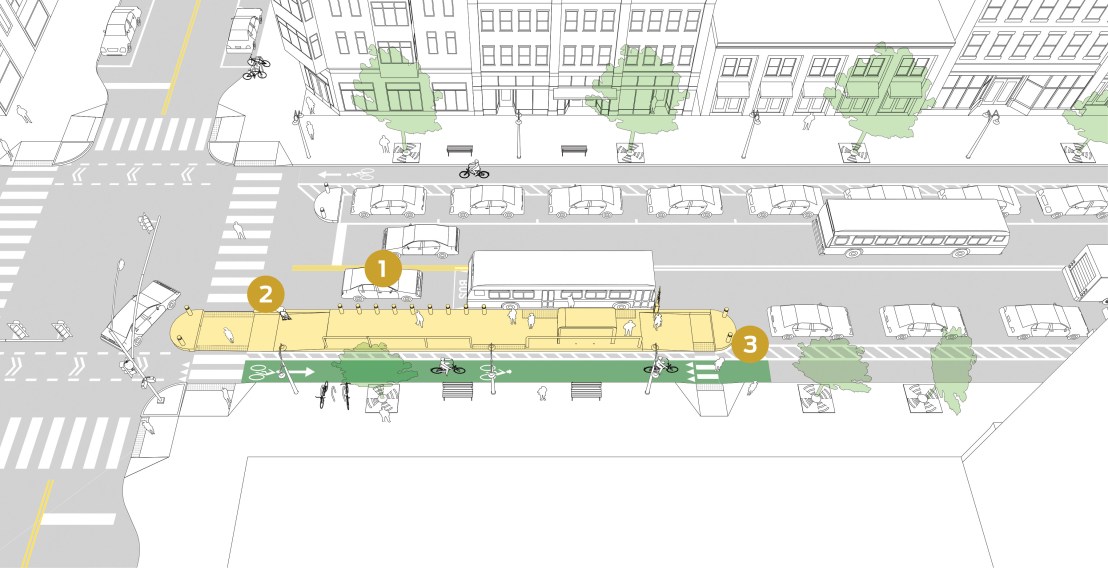
Transit advocates should remain open to bike facilities on transit priority streets, so below is a NACTO diagram with a right running protected bike lane which goes behind the bus boarding island, followed by a photo of use in San Francisco. No single diagram or photo is available that shows everything together, a continuous red transit-only lane with a continuous protected bikeway, but offering more diagrams and photos at least keeps the conversation open.
These facilities have already been installed in a number of other cities and work well. Of course with light rail and bus and bike lanes on a single street, there may be no room left for parking, but then what is the real meaning of a transit priority street if parking is guaranteed space. These are commercial streets, with deliveries required to some businesses, but this can be accommodated by restricting deliveries to hours when bus utilization is low or nonexistent.


2 thoughts on “Transit streets on 7th & 8th, revised”