SacRT has released for public comment the SacRT Bus Stop Improvement Plan, through Friday, February 3. To comment, go to the project page, and scroll down to the survey, or further down to submit a comment on the page.
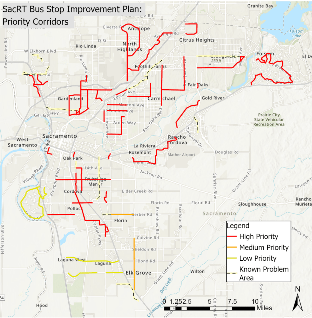
The plan was developed with the support of Civic Thread. Based on several criteria including equity, 60 corridors were identifies for analysis, shown on the map below. These are certainly not the only SacRT bus routes, but with 3100 bus stops in the service area, it was not possible to look at each one.
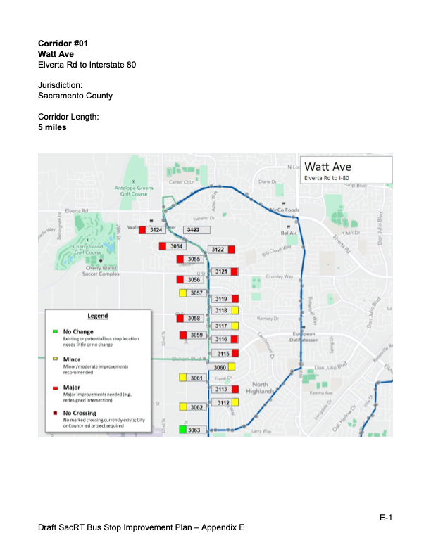
The detailed analysis is all in Appendix E. Unfortunately, there isn’t a linked reference to each corridor, so you will have to look in Appendix E pages 87-89 (88-90 of the pdf) to find the page number, then look in the correct one of six Appendix E documents to find the corridor you are interested in. An optimized/reduced version of the main document is available here (5MB vs 24MB), but you will have to download the six Appendix E documents from the SacRT page.
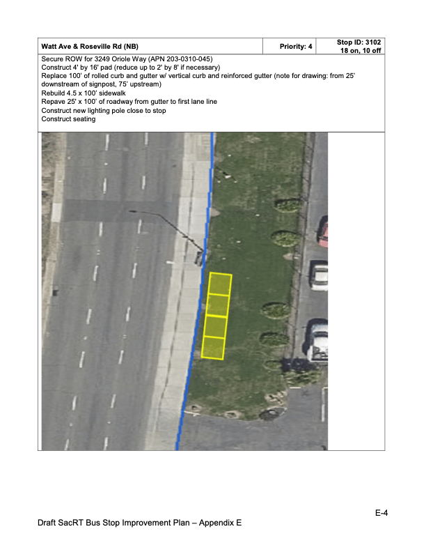
Two typical pages from Appendix E are below, a maps of stops, and an improvements page for a specific stop.

One thought on “SacRT Bus Stop Improvement Plan”