
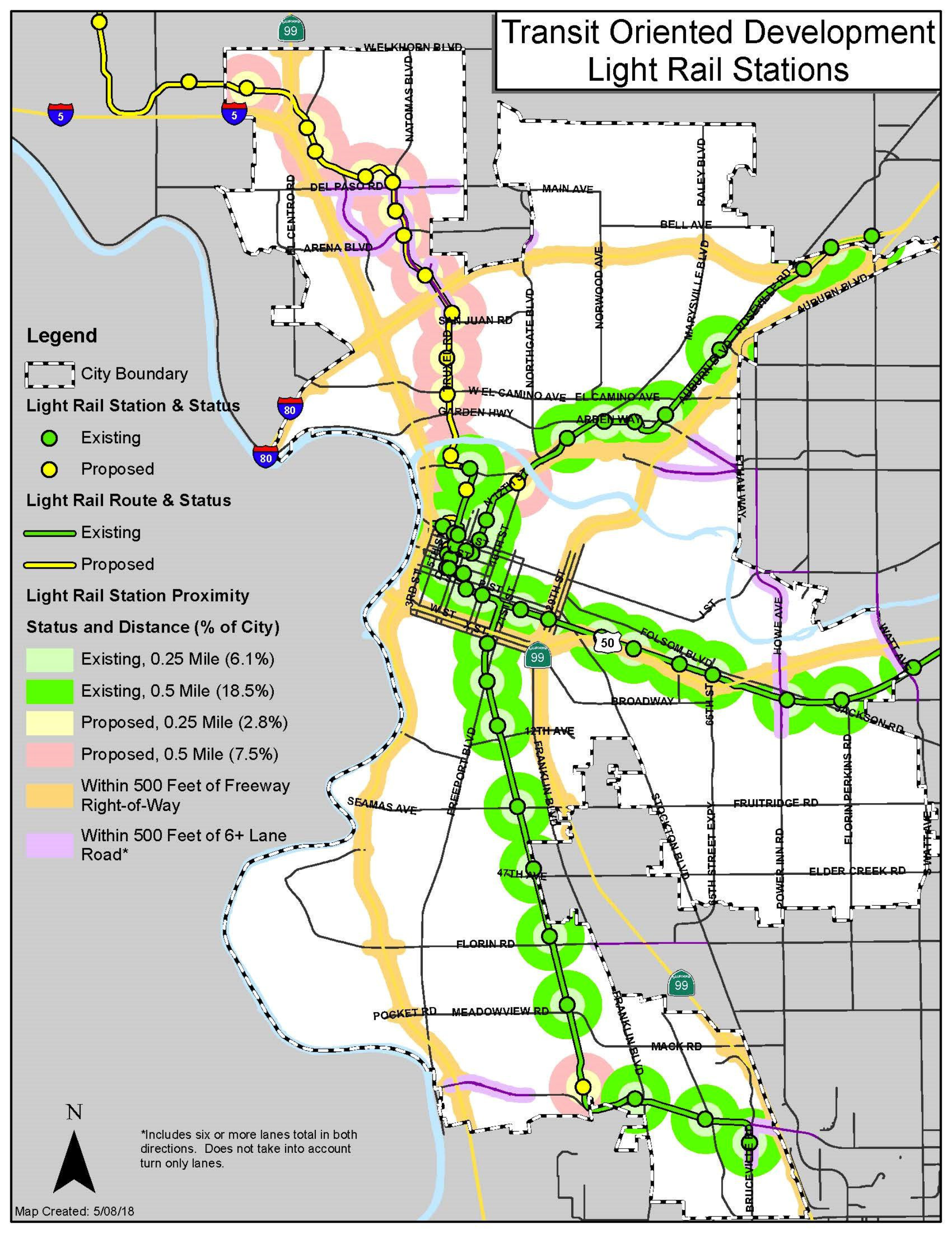
The Sacramento City Council passed the light rail Transit Oriented Development (TOD) ordinance on Tuesday evening. We will have more to say about that shortly, but in this post we will address the concern expressed by many opponents that their property (it was entirely property owners who were opposed) was in the 1/4 mile or 1/2 mile radius, and that wasn’t fair because they were on the other side of the freeway, tracks, or other impassable barriers.
First, the map included with the ordinance presentation. This map uses radii around each light rail station, 1/4 mile for the inner circle (lighter) and 1/2 mile for the outer circle (darker).
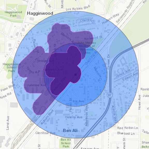
The Marconi light rail station was mentioned by a number of people (and so were other stations, but I picked this one). The concern was that there are properties on the southeast side of the light rail and UPRR tracks, and even on the other side of Interstate 80, that should be excluded from the ordinance. There is an easy way to deal with this issue, to use walking distance rather than radii (‘as the crow flies’). It would be easy to make these maps for each of the light rail stations. It took me about 10 minutes to make the one below. It was made with ArcGIS Online: Analysis: Use Proximity: Create Drive Time Areas, and Create Buffers. More accurate maps could be made with the ArcGIS Network Analyst, which I don’t have access to. This general mapping capability does not consider shortcuts that can be used by walkers and bicyclists, nor does it consider the quality of road crossings, which may not be safe in some areas. Nevertheless, it does provide a great first cut, and shows how remarkably difference walking distance and straight-line distance is.
The walk areas (often called ‘walk-sheds’), shown in purple, all stay northwest of the light rail station and light rail tracks. The difference between the 1/2 mile walk distance and the 1/2 mile radius (shown in blue) also shows sadly how disconnected the street network is to the northwest, which may in fact have much to do with the lower economic level of some of this area.
Would the 1/4 mile and half mile walking distance be the right quantities? I think that could be discussed, but the point here is that it is easy to create walk distance maps that reflect what we actually want for the area around a light rail station, which is walkability.

Great update on a important issue. Thank you for the explanations
LikeLike